Wednesday, July 8, 2020
Distance
4.7 miles
Elevation Gain
1,446 feet
Route Type
Out & Back
Difficulty: Medium
Tier: 1
Awesome hike! To be updated with more details..
Wednesday, July 8, 2020
Difficulty: Medium
Tier: 1
Awesome hike! To be updated with more details..
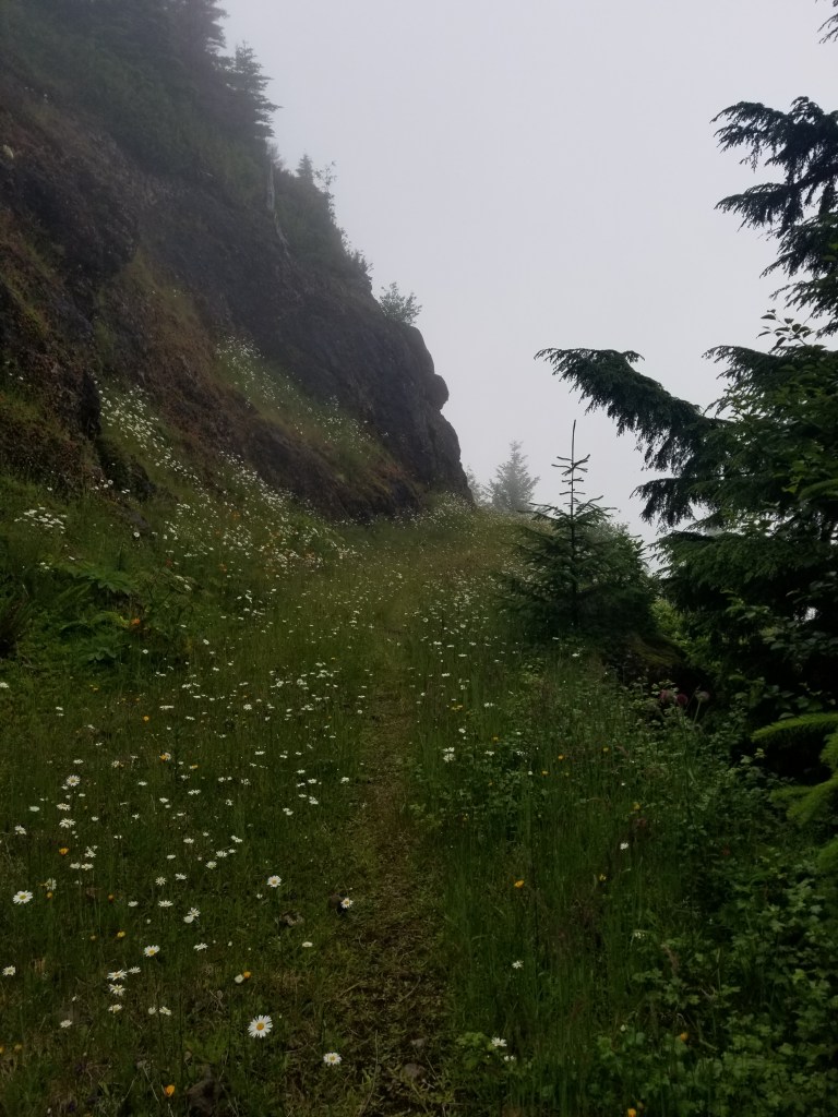
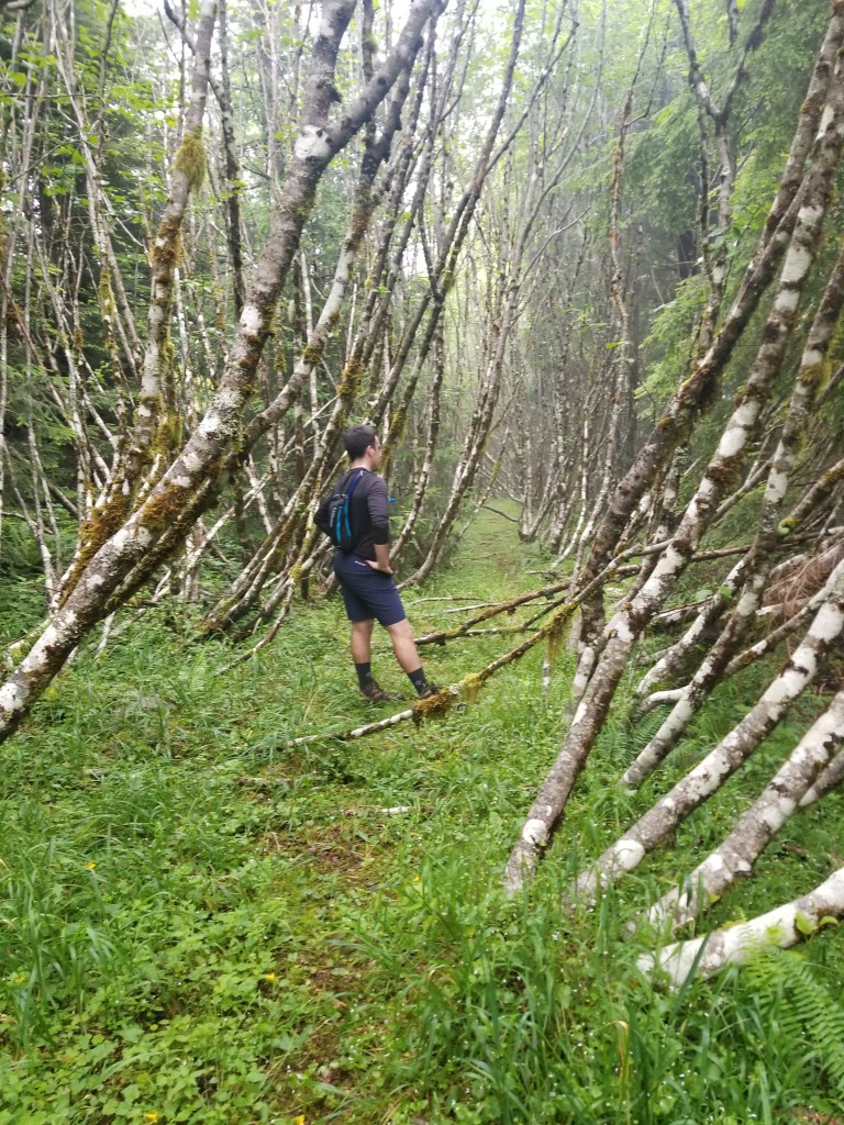
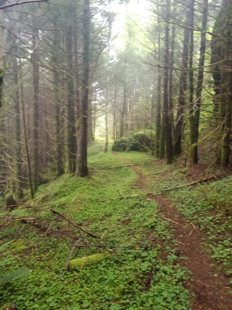
Saturday, July 4, 2020
Difficulty: Hard
Tier: 1
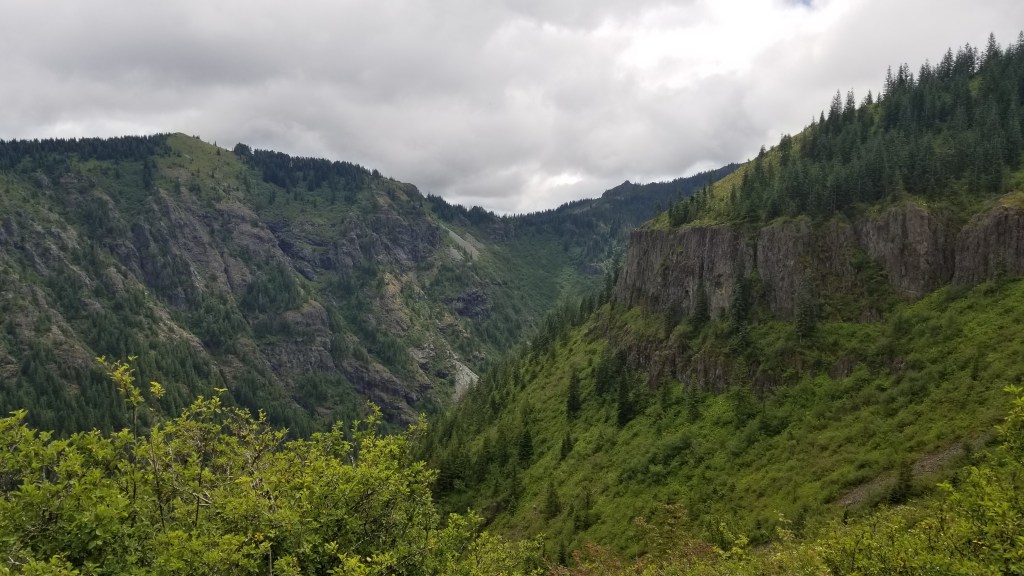
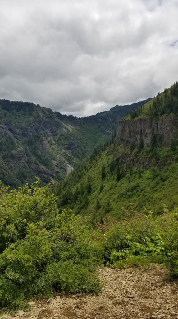
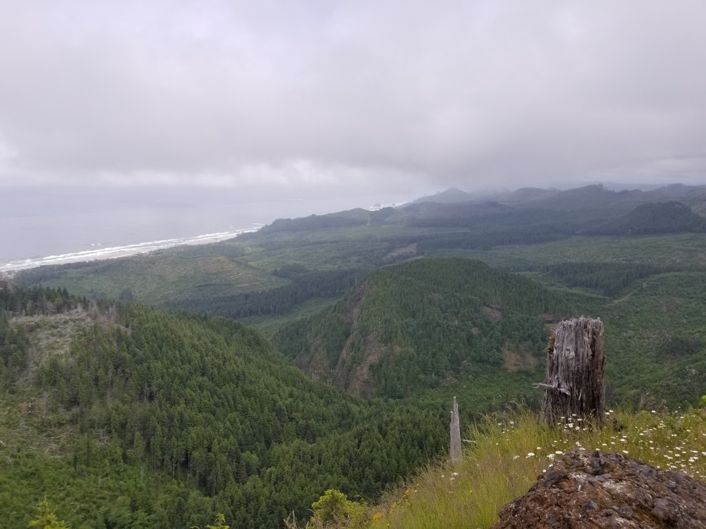
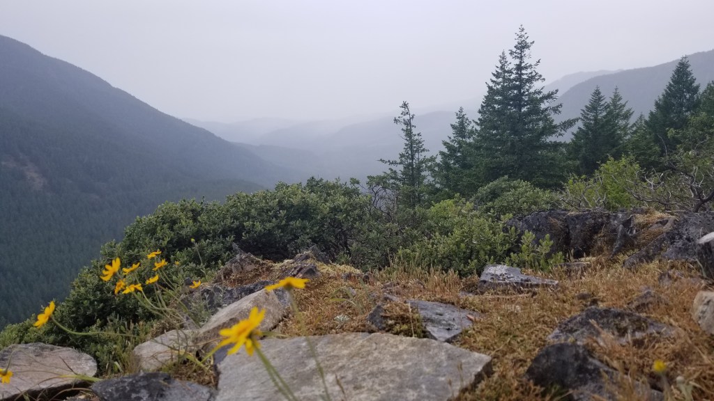
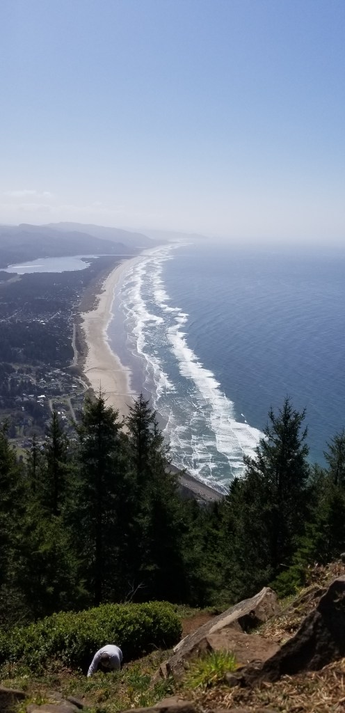
We picked this hike because it was lightly trafficked, and we wanted to hike on 4th of July. The hike starts with a 2 mile climb on a logging road. Beautiful, open view of the surrounding mountains and the coast. You can see Cannon Beach, Haystack Rock, and miles of the coastline. Right before the logging road comes to a dead end, there’s a pink marker with a small trail veering off to the right. Now prepare yourself 2 treacherous miles. Here is how we would describe it:
.5 miles of weedwacking and pokey nation + .5 miles of Enchanted Wildflower Wonderland + .25 miles of weedwacking and pokey nation+.25 miles of slug town +.25 miles of slanty, pokey, slug town+.1 miles of Red Rock Canyon+.25 miles of Enchanted Wildflower Wonderland+.25 miles of slanty pokey nation+.5 miles of Fairy tale Forest+.5 miles of straight bushwacking
But that doesn’t add up to 2 miles…believe me, we know. We were quite lost for a long time and ended up stopping at a random log. It was very peaceful. Maybe because it was a quiet, serene forest…or maybe because we were exhausted. Either way, it was lovely. We enjoyed our 1 granola bar, 5 m&m’s, and dried fruit–breakfast of champions.
Sunday, June 14, 2020
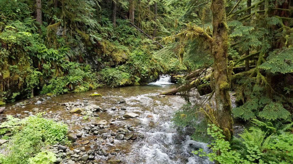
Difficulty: Medium
Tier: 3
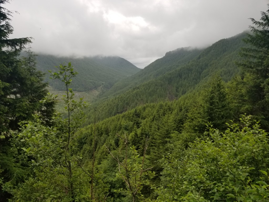
At the trailhead, there is immediately a fork in the trail. The trail to the right, we imagine, is popular, leads to the falls, and follows a creek. We hiked about a half mile of this portion after we already hiked for a few hours to the left. The left trail leads to a road, so we turned around. It seems relatively flat, but most of the elevation is at the end. It was muddy and had many bridges. There was one portion of walking through the creek where you had to scramble across rocks. It was very quiet and the tree coverage was beautiful. Our assumption is that the popular hike is to the right. If you don’t need the most scenic hike, it’s worth it to enjoy the serenity of the forest.
The road was winding and really rough for over 7 miles to the trailhead. We had to take it very slow even in our Subaru. A car with good clearance is very much necessary to get to the trailhead.
Saturday, June 20, 2020
Difficulty: Hard
Tier: 1
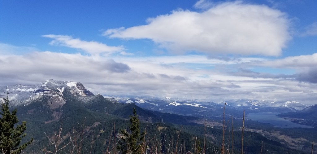
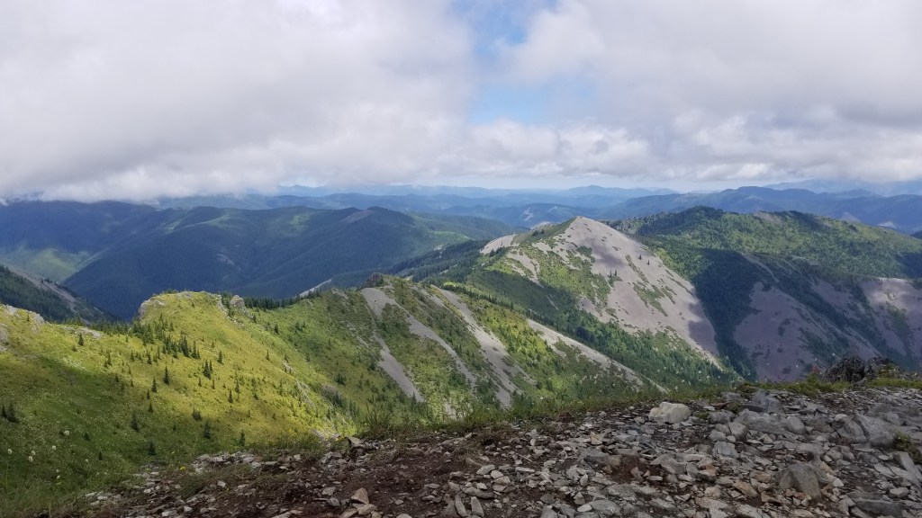
The trailhead is of the best kind. You drive through some winding service roads until you see the trailhead off to the side of the road. We parked along a pull out alongside the mountain. The hike starts immediately with switchbacks, gaining at least 1000 feet the first mile. Also, the hike claims to be 6.5 miles round trip, but it was much closer to 10. My fitbit also tracked about 3200 feet elevation gain. Also, there are many portions covered in rocks, so you have to watch your footing very carefully. About 2300 feet up, we hit a fork in the trail. To the right was the “false summit” which was very beautiful. We happened to go on a cloudier day, so we only caught a glimpse of Mount Jefferson. Even with all the clouds, we could see how vast and beautiful the views were. We continued up the trail and enjoyed a long break sitting along the final cliff simply listening to the wind, river, and birds. The hike past the false summit was quite tough–steep and a lot of brush to climb through, but it doesn’t last too long. We only saw two people the entire hike as well. Overall, the leg-burner was rewarded with a peaceful forest and incredible views! We’ll definitely be going back to this hike on a clear day!
The last couple miles were rougher on the roads. Potholes and gravel. Having a car with good clearance was helpful but not necessary at the time we drove this.
Saturday, March 22, 2020
Difficulty: Easy
Tier: 3
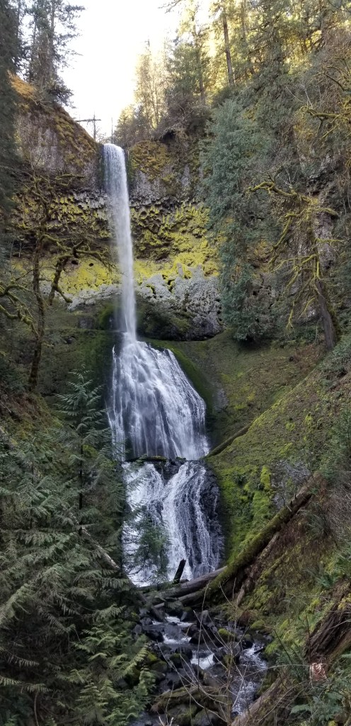
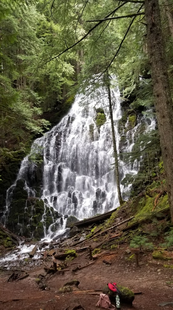
Overall, we weren’t big fans of this hike. For a large portion at the beginning of the hike, you can hear, and sometimes see, the road. It does open up to a nice river that was peaceful for awhile. But after that, you end up walking through a field with power lines above you. This lasted awhile before we got back into the forest. Shortly after, we reached the falls. It was pretty, but there wasn’t much area to relax and enjoy the view once you reached the end. This was also during coronavirus, so when we saw two other groups in the area, we didn’t stay long to enjoy the views to allow other people to get closer. We’d like to try the Indian Henry version of this hike to see if it’s more rewarding.
Wednesday, March 18, 2020
Difficulty: Moderate
Tier: 2
Wednesday, May 6, 2020
Difficulty: Moderate
Tier: 2
Saturday, May 23, 2020
Difficulty: Easy
Tier: 2
We did Ramona Falls on a dispersed-camping weekend by the Zig-Zag River. The hike itself was not challenging, but did require you to pay attention because of all the roots and rocks. The forest here is different. It’s quite beautiful, but it’s not the thick, green Oregon forest I’m used to. It was almost mystical. The trees were often light-colored with smaller trunks and light green moss hanging from the branches in little pockets. The way we took–going to the right first on the loop–stayed in this forest until we got deeper into the forest with bigger trees and suddenly the grand waterfall. Ramona Falls looked like it should have been in some hand-crafted Japanese Garden. There’s a nice area around the Falls too to sit down, appreciate the views, and have a snack. The way back was greener, with a creek along most of the path. You also get neat views of the rock wall on your right. Before the loop, you have to do a river crossing. There’s a lot of signs on the trail warning hikers on how to do this safely, especially when the water is high. When we went, we were able to walk across a fallen tree, using another fallen tree as support. It wasn’t difficult at all. But, I could see how it would be more treacherous in the rainier months. Another plus about this hike is the views you can get of Mount Hood on a clear day by driving slightly past the road to Ramona Falls. It’s only a few minute detour, but I’d highly recommend it!
Sunday, May 17, 2020
Difficulty: Hard
Tier: 1
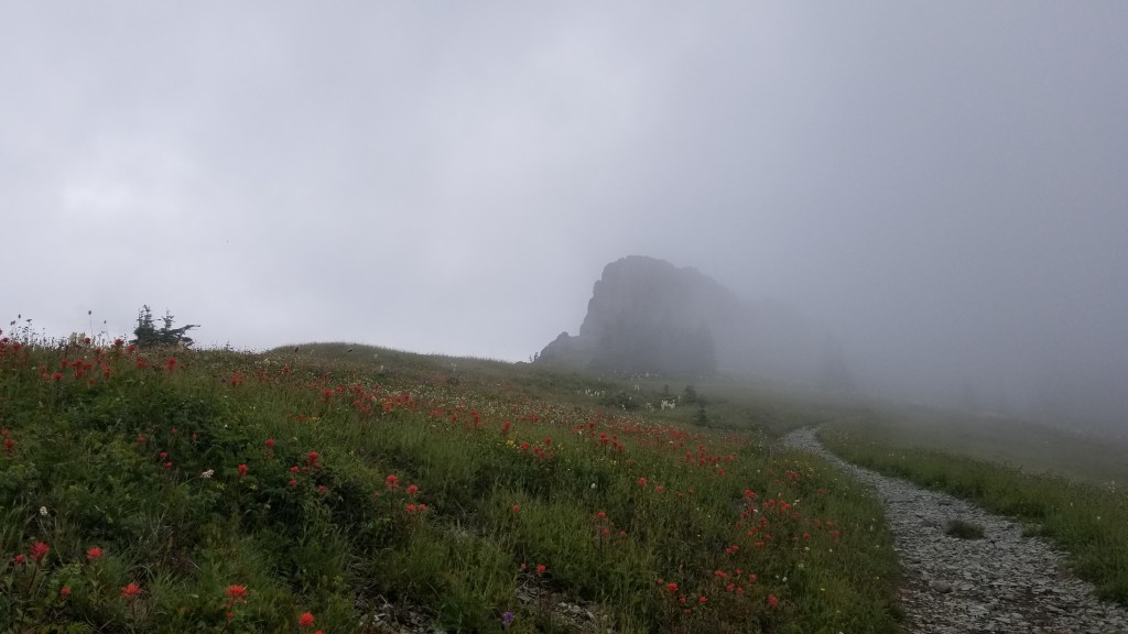
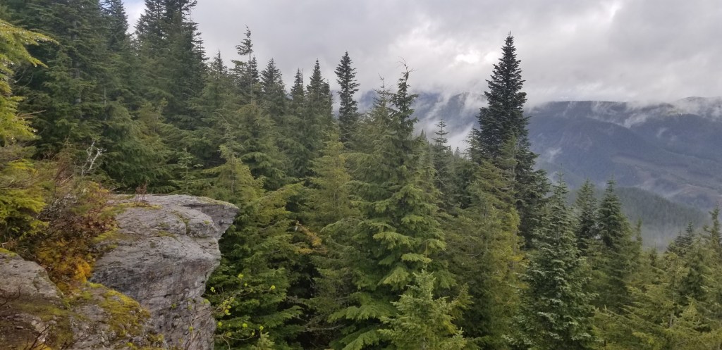
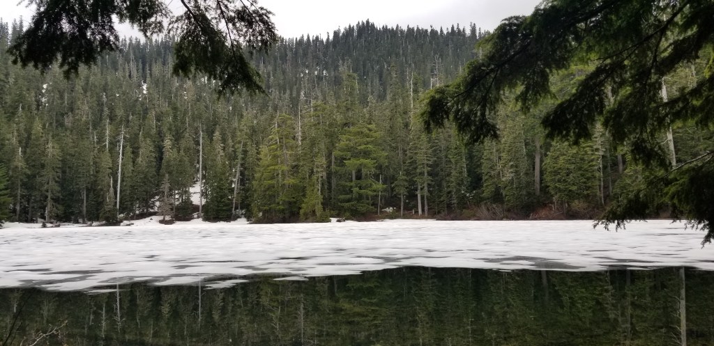
Secluded and quiet. This hike is immersed in the Gifford-Pinchot National Forest and completely draws you in to the deep forest, with moments where you can see out to more tree-covered mountains. The hike starts with about a mile and half of meandering before it gets to a fairly steep incline for the remainder of the hike. When we were there, there were many fallen trees covering the trail that we had to climb over, under, and around. The last quarter-mile or so was also covered with packed snow. The hike ends by a lake, enclosed by the mountain on all sides. It was pretty chilly at the top, but wonderfully peaceful.
A note on the drive there: You get to cross the Bridge of the Gods, which is absolutely beautiful, but it is a $2 fee each way. We also were on a rough-ish road for only about a half mile before it opened up to a parking lot at the trail head. We had to pay a $5 fee for doing the hike and put a tag in our windshield. There’s also a “bathroom” at the trailhead, but it was closed because of coronavirus when we were there.
And lastly, this was the hike where I slipped on the log crossing the river. I had a gorgeous black eye for weeks. So, be careful on slick surfaces!
Sunday, March 15, 2020
Difficulty: Moderate-Hard
Tier: 1
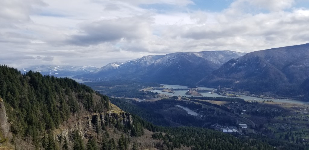
Review: Hamilton Mountain is located in Beacon Rock State Park on the Washington side of the gorge. When we got there, the temperature itself was not frigid, but the wind made it feel like winter was coming. Once we started on the trail, the tree cover provided much needed relief from the biting wind. Luckily I had a scarf, gloves, and multiple layers.
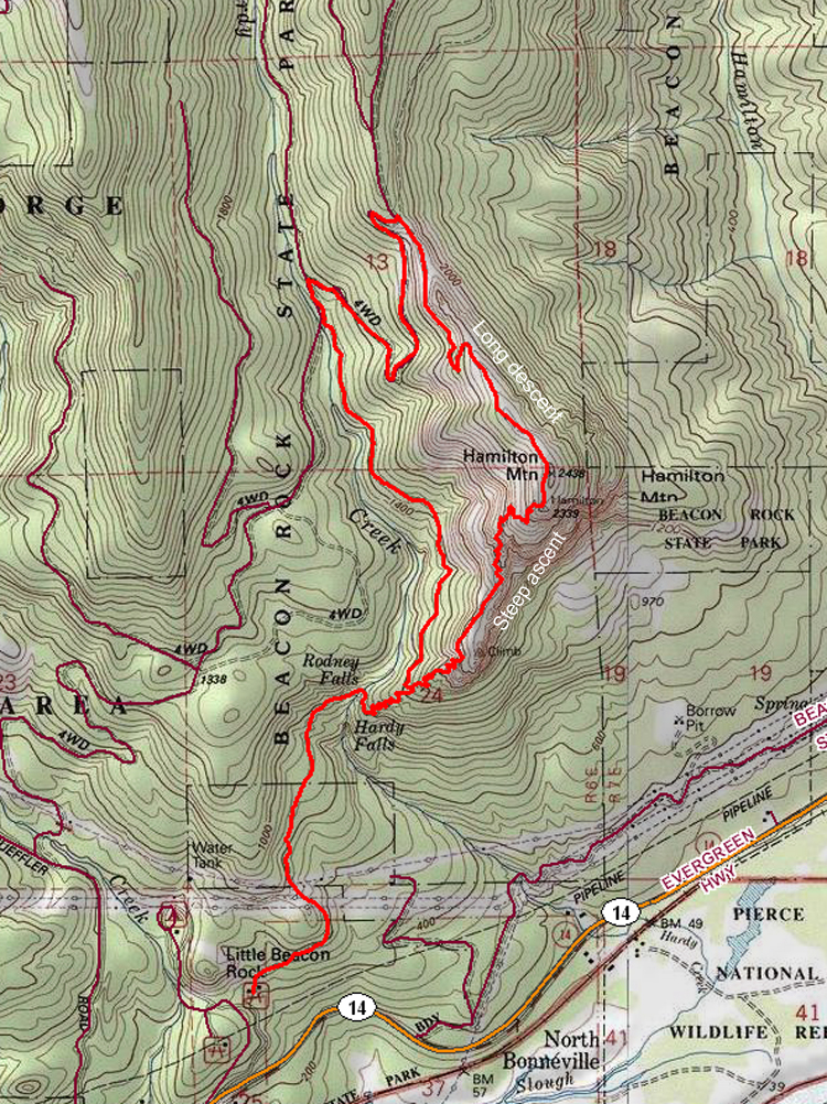
It was a pretty steady incline most of the way up. My cardiovascular endurance is not as great as I would like, and the beginning of a hike is typically a struggle. This one was no different. Though, much like running, there is always a wall to bust through. Once I found that rhythm, it became much easier to keep going. Back to the trail. There were some nice viewpoints in various spots going up, thouugh there was a climactic view about 70% of the way through the hike. It was a majestic sweeping panoramic of the gorge. If it was a clear day, you would be able to clearly see Mt. Adams on one side of the river. On the other side, you can see the gorge running down toward the west. We found a large boulder overlook to sit on a take a snack break.
We finished the remaining ~30% of the hike in the packed snow, reaching the peak after about 2 hours from the trailhead. Since it was a lollipop route, we looped around a different way down. Before descending, we had to walk across a saddle-like feature, completely exposed to the wind. The combination of high elevation and no tree cover made for an extremely windy traverse to the other side. Almost enough force to knock me over if I wasn’t careful. Pretty fun actually.
On the way back down, it was a more gradual decline. We finished the hike in about 3.5-4 hours. Overall a great trail. If you love the journey over the destination, this hike gives you what you need. But the destination is also fantastic, with amazing views of the entire gorge and surrounding features. The hike is moderately-high trafficked, and seems to be well-maintained. Be careful with the snow near the peak, it got somewhat slick at times. The parking lot was nice. It was with multiple port-a-potties, and a playground. In case you still have pent up energy after the hike, I suppose.